Our Story

Weston Mill’s Revolutionary Role

The Battle of Van Nest’s Mill—also known as the Battle of Millstone—took place in January 1777 at the site later known as Weston Mill. American militia engaged British foraging parties along the Millstone River, disrupting efforts to gather food and secure vital milling resources. The skirmish underscored the strategic importance of mills and river crossings in the war, as control of this site affected troop movement, supplies, and local support. Though small in scale, the action at Van Nest’s Mill contributed to the broader Patriot campaign that pressured British forces to withdraw toward New Brunswick following their losses at Trenton and Princeton.

Turning Grain into Growth: The mill as a community anchor

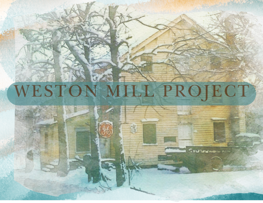
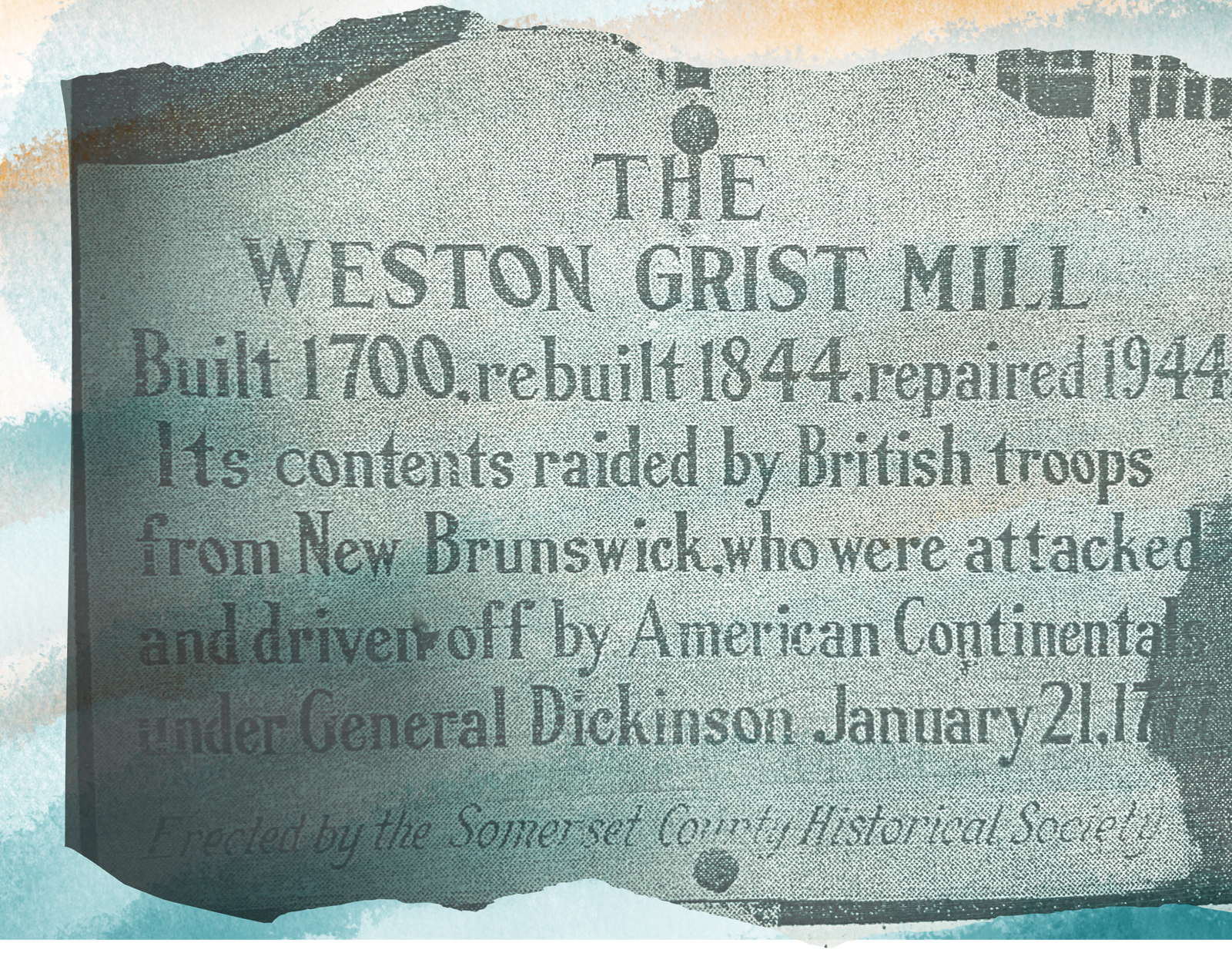
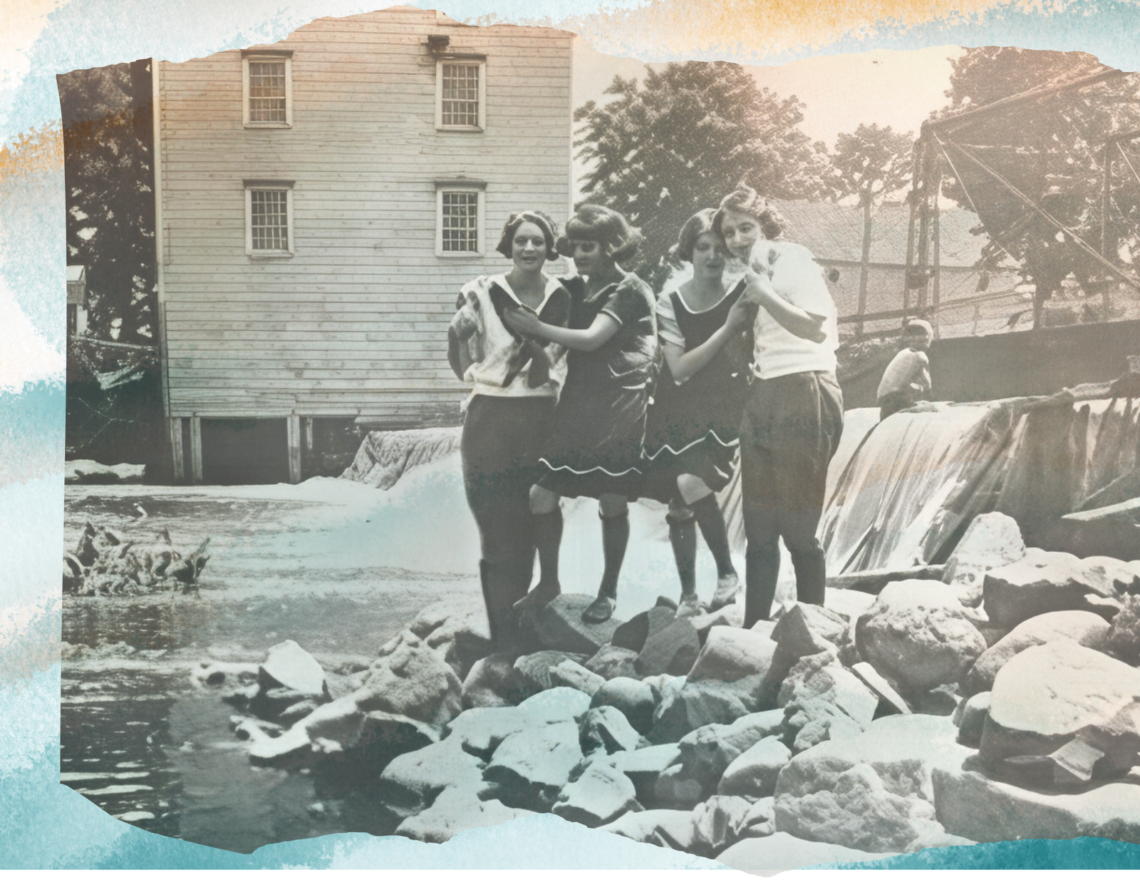
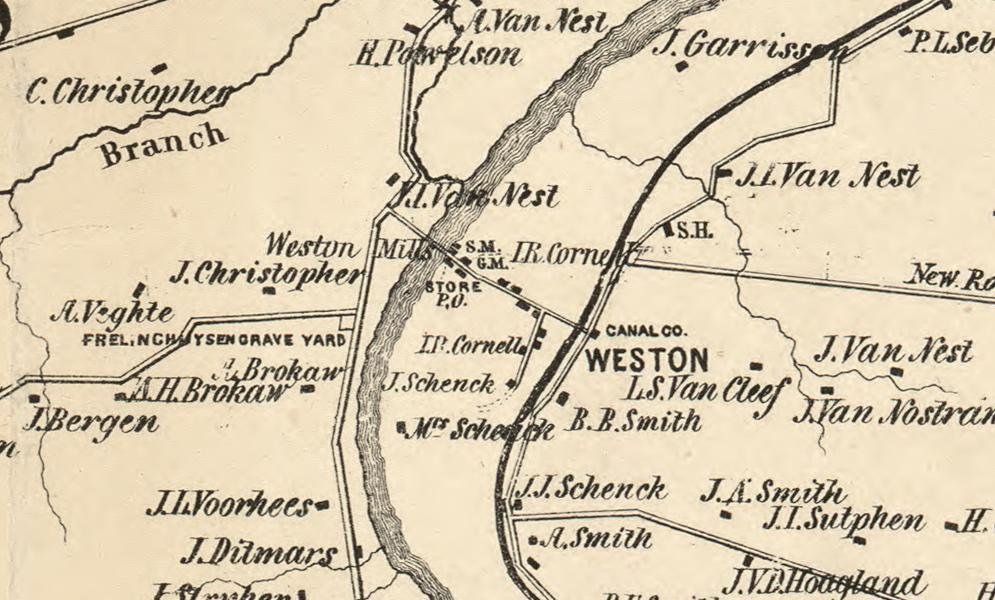
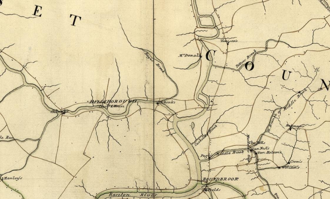
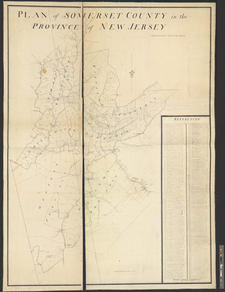
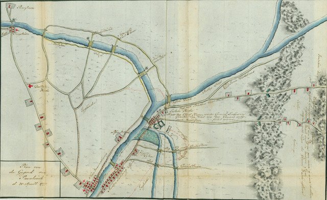
Grist mills were often the seeds from which towns grew. By harnessing nearby rivers and streams for power, mills provided an essential service—turning grain into flour—that drew farmers, merchants, and craftsmen to a central location. Roads and bridges developed to reach the mill, followed by houses, stores, churches, and schools. Over time, these mill sites became economic and social hubs, shaping settlement patterns and laying the foundation for many towns and communities across the region.

The Long Life of a Working Mill

The Weston Mill endured for centuries by continually adapting to new technologies while maintaining its vital role in the community. Originally powered by a traditional waterwheel, the mill evolved alongside advances in engineering, most notably with the installation of turbine engines in the 1800s that greatly increased efficiency and output. These upgrades allowed the mill to remain competitive through periods of agricultural and industrial change, extending its working life well beyond its colonial origins. The mill’s longevity stands as a testament to innovation, showing how early industries embraced emerging technologies to meet the needs of each new generation.

A brief history of the Weston Mill in the publication titled "Historic Somerset"

Historical maps depicting the location of the Weston Mill

(Click on maps to enlarge)

Otley, J. W, James Keily, Lloyd Van Derveer, and Robert Pearsall Smith. Map of Somerset County, New Jersey: entirely from original surveys. Camden, N.J.: Published by Lloyd Van Derveer, surveyor, 1850. Map. https://www.loc.gov/item/2012593680/. Library of Congress, Geography and Map Division.
Library of Congress, Geography and Map Division.
"Plan of Somerset County in the province of New Jersey : Copied from the original by Lieut. I. Hills, asst. engr. / survey'd by Benjamin Morgan in 1766.". https://quod.lib.umich.edu/w/wcl1ic/x-586/wcl000691. In the digital collection William L. Clements Library Image Bank. William L. Clements Library, University of Michigan Library Digital Collections. January 24, 2026.
Plan of the Area of Bound Brook, 20 April 1777. Bloomsburg University Archives, Bloomsburg University of Pennsylvania

Weston Mill History and Artifacts, Millstone River, New Jersey by John Jengo

Meet Wilbur Smith, the last owner of the Weston Mill